
How to Read the New York Map Without Getting Lost
Three levels with the same name
If you send a letter to someone living in Manhattan, the envelope says "New York, NY". The first "New York" is the city and the letters "NY" are the state. The same name appears twice in one line, and each time it designates a different government, with its own territory, its own taxes, and its own authorities.

New York City, which Americans abbreviate as NYC, occupies a small piece of the southeastern tip of the state. New York State, abbreviated as NYS, is much larger. It stretches north to the Canadian border, covering forests, mountains, dairy farms, and cities like Buffalo or Rochester, and has its capital in Albany, about a three-hour drive from Manhattan. Many people are surprised to learn that the country's most famous city is not the capital of its own state.
Above both is the United States, a federation of 50 states. Think of a Russian nesting doll with three layers.
- The United States, with its federal government in Washington, which manages currency, the military, and foreign policy.
- New York State, with its governor and legislature in Albany, which dictates much of civil, criminal, and educational law.
- New York City, with its mayor and city council, which manages the local subway, police, garbage collection, and public schools.
- Federal
- State
- Municipal
- Seat of government
- Main authority
- National scope
- State scope
- Local scope
- Washington, D.C.
- President
- Military defense
- Armed forces and border security.
- Currency and banking
- Currency issuance and interest rate policy.
- Foreign trade
- International treaties and tariffs.
- Albany, NY
- Governor
- Main highways
- State highways and road connectivity.
- Educational curriculum
- School standards and budgets.
- Licenses
- Driver's licenses and professional credentials.
- City Hall, New York
- Mayor
- Subway network
- Urban bus and train transit.
- Neighborhood police
- Preventive patrols and public order.
- Waste collection
- Urban cleaning and road maintenance.
A New Yorker lives under all three layers at once. When paying taxes, they may pay the federal, state, and municipal governments, and when voting, they choose authorities at all three levels. For someone coming from a Latin American country, the state functions somewhat like a department or province with a great deal of autonomy, and the city like a municipality that, due to its size, has uncommon powers.
The five boroughs that make up the city
New York City is divided into five districts called boroughs. Manhattan is just one of them, even though in the movies it looks like the entire city. The other four are Brooklyn, Queens, the Bronx, and Staten Island, and together they were united under a single municipal government in 1898, when the so-called Greater New York was born.
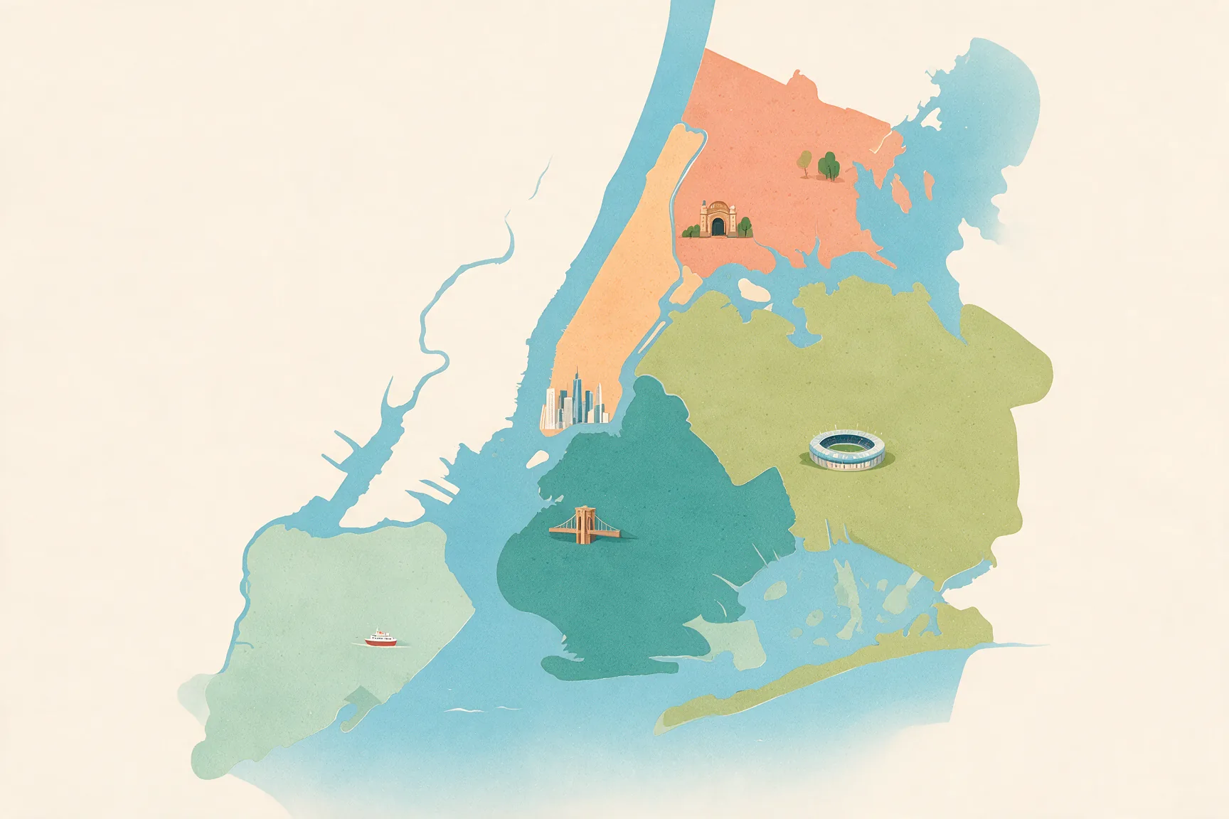
Each borough corresponds exactly to a state county, that is, one of the territorial divisions into which the state organizes its courts, registries, and elections. The curious thing is that several counties have different names from their boroughs.
| Borough | County |
|---|---|
| Manhattan | New York County |
| Brooklyn | Kings County |
| Queens | Queens County |
| Bronx | Bronx County |
| Staten Island | Richmond County |
That dual identity explains why a Brooklyn courthouse appears in documents as "Kings County Supreme Court." In the rest of the state, each county has its own government with officials and a budget. Within the city, on the other hand, the five counties merged with the municipality and barely retain their own functions, such as the district attorney's office.
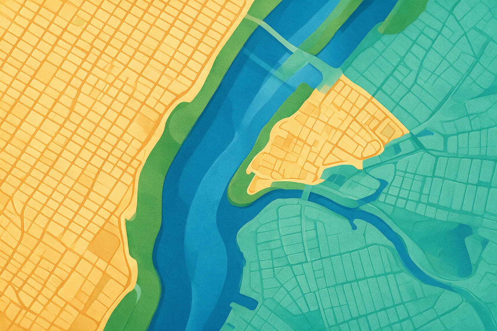
The boundaries match almost perfectly. The exception geographers always mention is Marble Hill, a neighborhood that legally belongs to Manhattan but ended up attached to the Bronx on the mainland after the canal separating it was filled in. Its residents vote as Manhattanites and walk to the Bronx to buy bread.
The 1811 Manhattan grid
In 1811, when the city barely occupied the south of the island, three commissioners approved a plan for what were still hills, farms, and swamps to the north. The Commissioners' Plan laid out a grid of avenues running north-to-south and streets crossing it east-to-west. They also decided to number them instead of giving them names, a practical and unromantic choice that turned the island into a large Cartesian plane.
The avenues run from First to Twelfth, counting from east to west. The streets start at 1st Street and go north up to 155th Street in the area covered by the plan. Thus, 42nd Street is south of 57th, and Third Avenue is east of Seventh.
Most cross streets were laid out at 60 feet wide, about 18 meters. Some, like 14th, 23rd, 34th, 42nd, 57th, 72nd, or 125th, were given 100 feet, about 30 meters, and today they remain the major commercial and traffic corridors crossing the island. If you exit the subway at 34th, you are on a wide street full of shops, and that stems from a decision made over two centuries ago.
- Sidewalk
- Roadway
- Ordinary street
- Major avenue
- Plan
- Section
- ft
There is a detail that confuses visitors with a compass. The grid does not point to true north because it follows the elongated shape of the island and is rotated about 29 degrees to the east. New Yorkers still call the direction of the avenues "north," and that conventional north is what subway maps and directions use.
- True North
- Grid North
- North 0°
- 29° Grid
- Avenues
- Streets
- Hudson River
- East River
- N
- E
- Eastern deviation
- Orientation angle in degrees
- 0° (True North)
- 29° (Avenues axis)
- Geographic north (meridian)
- Avenues axis (Manhattan)
The Fifth Avenue rule, East versus West
Fifth Avenue splits Manhattan into two halves for addressing purposes. Everything to the east of it carries the word East and everything to the west carries West. That is why 10 East 42nd Street and 10 West 42nd Street exist at the same time, two buildings on the same street on opposite sides of Fifth.
- 42nd Street
- West
- East
- 42nd St
- Between
- 6th Ave & 5th Ave
- 7th Ave & 6th Ave
- 8th Ave & 7th Ave
- 9th Ave & 8th Ave
- 10th Ave & 9th Ave
- 11th Ave & 10th Ave
- 5th Ave & Madison Ave
- Madison Ave & Park Ave
- Park Ave & Lexington Ave
- Lexington Ave & 3rd Ave
- 3rd Ave & 2nd Ave
- 2nd Ave & 1st Ave
- 5th Ave block
- 5th Ave blocks
- Hudson
- East River
- 11th
- 10th
- 9th
- 8th
- 7th
- 6th
- 5th AVE
- Mad
- Park
- Lex
- 3rd
- 2nd
- 1st
- Manhattan Side
- Address number
- Address number from 1 to 600
- 1 (5th Ave)
- 600 (River)
The building number also tells you something. On cross streets, numbering starts at Fifth Avenue and increases as you move away from it, both eastward and westward. A small number, like 10, indicates you are close to Fifth, while a high number, like 500, sends you several avenues further.
With those two clues you can decode an address in seconds. Imagine a friend invites you to meet them at 350 West 50th Street. The word West tells you to go west of Fifth Avenue, the 50th places you on 50th Street, and the 350 indicates that you are not right next to Fifth Avenue, but rather several blocks away, toward Eighth or Ninth Avenue. You just need to walk.
Addresses on the avenues themselves work differently. There, the building number does not match the nearest street, and to figure it out New Yorkers use an arithmetic trick that involves dividing the number by 20 and adding a different value depending on the avenue and section. In practice, almost everyone just asks "what streets is it between?", and advertisements usually answer in advance with formulas like "Fifth Avenue at 34th Street".
Broadway and the southern exceptions
The grid has a famous rebel. Broadway is much older than the 1811 plan, because it follows a path that already existed since colonial times, and it cuts diagonally across the island, intersecting the avenues. Every time it crosses one of them, it leaves a triangular or bow-shaped plaza, which is how Times Square—where Broadway intersects Seventh Avenue—and Herald Square—where it intersects Sixth Avenue—were born.
The south of the island completely escaped the plan. Lower Manhattan, the Wall Street neighborhood, preserves the layout of narrow, curved streets left by the Dutch and later the English, with proper names like Pearl, Beaver, or Maiden Lane instead of numbers. There, the rule of numbers does not apply, and the map reads like the historic center of any Latin American colonial city.
Greenwich Village is the most baffling case. The neighborhood already had its own streets when the grid arrived, and its residents resisted the new layout erasing them. As a result, some numbered streets twist as they enter the Village, and West 4th Street ends up intersecting West 10th Street, a corner that theoretically should not exist.
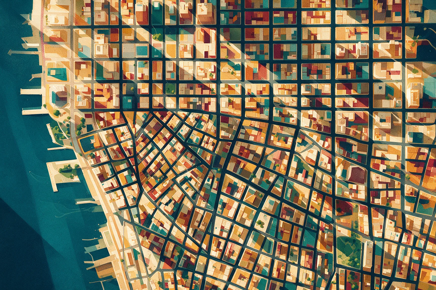
As a general rule, the grid governs north of 14th Street, roughly speaking. Below that line, you would do well to carry a map and some patience.
Uptown, Downtown, and Midtown
In Manhattan, nobody says \"I'm going north\" or \"I'm going south.\" They say they are going uptown or downtown. Uptown means heading north toward higher street numbers, bound for Harlem. Downtown means heading south toward lower numbers, bound for Wall Street. The logic stems from the grid itself, because going from 20th Street to 80th Street is literally going \"up\" on the map.
Words also name areas of the island. Downtown designates the south, from the Village to the tip. Midtown is the central strip, roughly between 34th and 59th streets, where the office skyscrapers, Times Square, and Grand Central Station are located. Uptown refers to everything north of Central Park, although it already feels like uptown in the Upper East Side and Upper West Side.
This vocabulary matters most in the subway. Many Manhattan stations have separate entrances depending on the train's direction, with signs reading "Uptown" or "Downtown," and if you enter through the wrong one, you cannot always cross to the other platform without exiting and paying again. Before going down the stairs, compare your destination with the street where you are. If you are going from 14th to 42nd, the number goes up, so you look for the Uptown entrance.

Sources
References
- Commissioners' Plan of 1811 — 2004
- The Commissioners' Plan, 1811 - Greatest Grid
- The Greatness of the Grid - City Journal — 2023
- archives.nypl.org -- Commissioners' plan of Manhattan Island ... — 2014
- Commissioners' Plan Develops Manhattan Street Grid As We Know It — 2015
- Commissioners’ Plan von 1811 – Wikipedia — 2005
- How Many NYC Blocks Are in a Mile? — 2026
- Designing the City of New York: The Commissioners' Plan ... — 2010
- New York
- List of counties in New York - Wikipedia — 2002
- Local Government & Laws - New York Resources — 2015
- New York City Counties · NYC311 - NYC.gov
- County Government · GitBook - NY.Gov — 2019
- City of Greater New York - Wikipedia — 2004
- § 2-202 Division into boroughs and boundaries thereof.
- Manhattan address algorithm — 2010
- The Manhattan Grid | NYC Odyssey
- How do the city's street grids and numbering systems work — 2026
- Street Locator Algorithm - ny
- Fifth Avenue - Wikipedia — 2003
Audiovisual sources
- map of New York city's 5 boroughs — ilmioviaggioanewyork.com
- Commissioner's Plan 1811-Map-NYC-Library of Congress-005 — untappedcities.com
- new york city canal street subway station stairs - subway station entrance stock pictures, royalty-free photos & images — gettyimages.in
- The Danby at 170 West 225th Street in Marble Hill, Manhattan via NYC Housing Connect — newyorkyimby.com
Frequently asked questions
What is the difference between New York City and New York State?
New York City (NYC) occupies a small piece of the southeastern tip of New York State (NYS). New York State stretches north to the Canadian border and has its capital in Albany, while NYC has its own mayor and city council managing the subway, police, garbage, and public schools.
What are the five boroughs of New York City?
New York City is divided into five boroughs: Manhattan, Brooklyn, Queens, the Bronx, and Staten Island. They were united under a single municipal government in 1898, when Greater New York was born.
Which county does each New York City borough correspond to?
Manhattan is New York County, Brooklyn is Kings County, Queens is Queens County, the Bronx is Bronx County, and Staten Island is Richmond County. Three of these counties have names different from their boroughs.
How does Fifth Avenue divide Manhattan addresses into East and West?
Fifth Avenue splits Manhattan into two halves for addressing. Everything east of it carries the word East and everything west carries West, which is why 10 East 42nd Street and 10 West 42nd Street exist at the same time.
How do I figure out where a Manhattan address is located?
For an address on a numbered street, East or West tells you the side of Fifth Avenue, the street number gives you the height, and the building number tells you how far from Fifth it is. Numbering starts at Fifth Avenue and increases as you move away from it in both directions.